
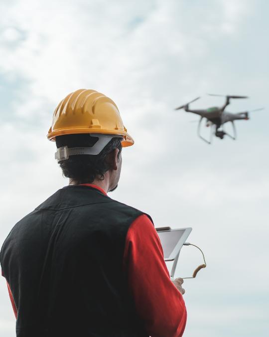
Drone Monitoring
Traditional ground-based surveillance has limitations — many critical operations require aerial visibility, wide-area coverage, and rapid response capabilities across challenging terrains. Our Drone Monitoring Solutions provide advanced unmanned aerial surveillance systems that deliver real-time video, thermal imaging, and AI-powered intelligence from above, wherever and whenever you need it.
What is Drone Monitoring?
Our Drone Monitoring Solutions are designed for environments where conventional surveillance cannot reach or provide adequate coverage.
Using advanced unmanned aerial vehicles, autonomous flight systems, and intelligent video analytics, the system enables:
- Aerial surveillance across large or inaccessible areas
- Real-time video streaming with HD/4K resolution
- Automated patrol routes with GPS waypoint navigation
- Thermal and night-vision imaging capabilities
- AI-powered object detection and tracking
- Instant alerts for security breaches and anomalies
Drone-mounted, cloud-based, and rapid-deploy ready kits are available, ensuring full flexibility and rugged outdoor performance.
Key Features of Drone Monitoring
Real-time monitoring from aerial units, vehicles, drones, or fixed stations.
01
Multi-Rotor & Fixed-Wing Platforms
Flexible drone options from compact quadcopters to long-endurance fixed-wing UAVs for extended operations.
02
Autonomous Flight & AI Navigation
Pre-programmed flight paths, obstacle avoidance, return-to-home functionality, and autonomous patrol missions.
03
HD/4K & Thermal Imaging
High-resolution optical cameras combined with thermal sensors for day/night operations and heat signature detection.
04
Real-Time Video Streaming
Live video transmission via 4G/5G/Wi-Fi connectivity to central command centers or mobile monitoring stations.
05
Beyond Visual Line of Sight (BVLOS)
Extended range operations with secure long-distance transmission for critical surveillance missions.
06
AI-Powered
Analytics
Intelligent detection of people, vehicles, intrusions, and anomalies with automated alerts and tracking.
07
Weather-Resistant
Design
Industrial-grade drones built to operate in adverse weather conditions including rain, wind, and extreme temperatures.
08
Integrated VMS & Drone Fleet Management
Centralized platform for managing multiple drones, reviewing footage, coordinating missions, and storing video data.
Why Businesses Need Drone Monitoring?
- Monitor large-scale sites and remote infrastructure efficiently
- Gain an aerial perspective for high-value area surveillance
- Respond faster to security incidents with aerial mobility
- Reduce costs compared to manned aircraft or helicopter patrols
- Protect temporary or remote facilities without fixed infrastructure
- Conduct routine safety and compliance inspections
- Monitor crowds, traffic, and large outdoor events efficiently
- Provide evidence footage during incidents
- Enable proactive threat detection from elevated vantage points
- Ensure workforce safety in hazardous or hard-to-reach locations
Industries we protect
Whether it’s monitoring construction sites, border patrol, large infrastructure projects, or ensuring mission-critical asset security across remote locations, our solution ensures maximum visibility and rapid security response — anytime, anywhere.
Construction & Infrastructure Sites
Real-time progress monitoring, site security surveillance, equipment tracking, theft prevention, and safety compliance inspections.
Energy & Utilities
Power line inspections, pipeline monitoring, solar farm surveillance, wind turbine assessments, and perimeter security for substations.
Agriculture & Plantations
Crop monitoring, pest detection, irrigation management, livestock tracking, and large-scale farm security operations.
Ports & Maritime Operations
Port security, vessel tracking, cargo monitoring, perimeter surveillance, and coastal border patrol missions.
Government & Defense
Border surveillance, disaster response, search-and-rescue operations, crowd monitoring, and critical infrastructure protection.
Events & Large Gatherings
Crowd management, security monitoring for festivals, concerts, sports events, and public gatherings with aerial oversight.
Frequently Asked Questions
Can drones be deployed where drone flights are usually restricted?
Yes. We ensure compliance with local aviation authorities and can obtain necessary flight permits and BVLOS authorizations for restricted airspace operations.
What is the typical flight endurance and coverage?
Multi-rotor drones provide 20-45 minutes of flight time covering 2-5 km radius, while fixed-wing UAVs can operate for 60+ minutes covering 10-20 km range depending on configuration.
Can drones operate autonomously without a pilot?
Yes. Our systems support fully autonomous missions with pre-programmed waypoints, scheduled patrol routes, automated takeoff/landing, and emergency return-to-home protocols.
Can thermal imaging detect people hiding at night or in dense areas?
Absolutely. Thermal cameras detect heat signatures even in complete darkness, through smoke, or in densely vegetated areas where optical cameras cannot see clearly.
Can multiple drones be monitored from one dashboard?
Yes. Our centralized fleet management system allows operators to monitor, control, and coordinate multiple drones simultaneously from a single command interface.